|
|
| |
| |
|
Size: 18,418 hectares.
Distance from San José: 240 kilometers.
Camping: Permitted.
Trails: Yes.
Dry season: January through March
|
|
 |
| |
|
 |
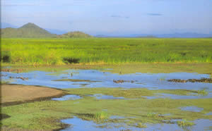
Palo Verde National Park protects a portion of what is
called the Río Tempisque lowlands, an amazingly diverse patchwork of habitats,
including freshwater and saltwater marshes, deciduous, riparian and evergreen
forests; and mangrove swamps. |
|
| |
|
The marshes are an extremely important stopover point for migratory
animals and in January and February the largest concentration of wading
birds in Central America can be found here. |
 |
|
| |
|
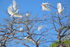 |
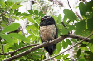
The park's many birds migrate to the region during the dry season, including storks, egrets, ibis, grebes and spoonbills. Pajaros Island (Isla de Pajaros), in the middle of the Tempisque River, is particularly eye-catching as it is home to many exotic bird species. The island is the largest nesting site for the black-crowned night-herons in Costa Rica and boasts other avian exotics such as the great curassow, toucans and macaws |
|
| |
|
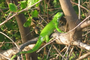
The Catalina sector of the park, in the northeast area,
contains interesting primary forest, but no trails per se. It's common
to see animals like pizotes, querques, collared peccaries, coatis, white
tailed deer, spotted skunks, white-face monkeys, iguanas and many
more. |
 |
|
| |
|
Back to Map of Costa Rica and its National Parks |
|
|