| |
Hitoy-Cerere Biological Reserve
|
| |
Size: 9.154 hectares.
Distance from San José: 219 kilometers.
Trails: Yes.
Dry season: None. |

|
| |
|
 |
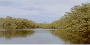
Hitoy-Cerere derives
its name from two words in a local indigenous language, hitoy means "wooly",
in reference to the green blanket that covers everything and cerere means,
"water", because of the abundance of rivers and streams. |
| |
|
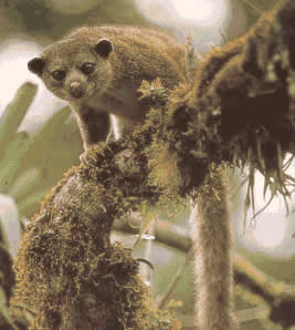
This park hasn't
been studied in depth and its not often visited, because of its precipitous
terrain and wet climate but these two factors have produced a biological
diversity that may prove to be one of the richest in Costa Rica. |
 |
| |
|
 |
The temperature
is consistently warm with daytime temperatures averaging around 25 degrees
C and rain is possible any time of the year. |
| |
|
The reserve is
surrounded on three sides by indigenous people's reserves, the Telire
to the west, Talamanca to the South and Tayni to the north. To the east
and in the lowlands are the massive banana plantations of the Estrella
valley and it is through this area that the reserve is accessible. |
 |
| |
|
| Back to Map of Costa Rica and its National Parks |
| |
|