| |
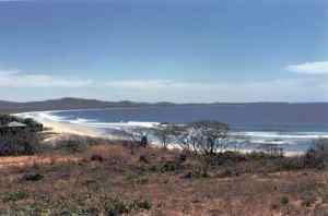
Las Baulas National Park |
Size: 612 hectares .
Distance from San José: 321 kilometers.
Trails: Yes. Along the beach.
Dry Seaon: January through March. |
|
 |
| |
|
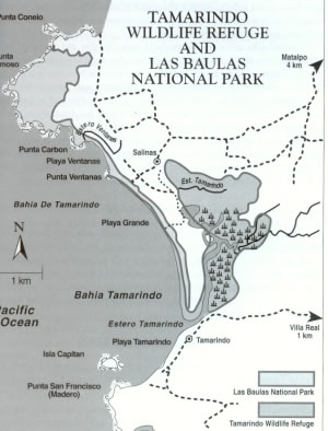
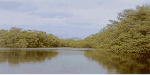
Four hundred and forty hectares of this park consist of a mangrove swamp at Tamarindo. There are six known species of mangrove that grow on this pacific coast, where an abundance of black mangrove can be found, suggesting concentrations of salt in the soil of Tamarindo swamp.
|
| |
|
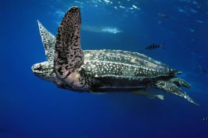
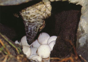
Playa Grande is a very important nesting beach for the leatherback turtle (Baula is the Spanish name for this species). This is the world's largest and most wide-ranging sea turtle, nesting in beaches from Surinam to Malaysia and some individuals have been found as far north as Iceland and Scandinavia. Leatherbacks arrive at Tamarindo in early October and nest until March, with the peak of activity occurring during November and December.
|
| |
|
Pottery has been found at the archeological
sites of Matapalo and Herta Aguacate, adjacent to the park. The artifacts
found are mainly bowls of different sizes that are decorated with blackish
coffee colored engobe, and complicated geometrical designs.
|
| |
|
The park is located on the Nicoya peninsula, near the town of Salinas, heading on Highway 21 to Filadelphia (26 kilometers), then 25 kilometers to Huacas and finally 8 more to Matapalo on a dirt road.
|
| |
|
|
Back to Map of Costa Rica and its National Parks
|