   |
| HOME: COUNTRY MAP: GUANACASTE: Guanacaste National Park map | ||
| Español | Recommend
this site to a friend! |
|
Guanacaste National Park |
|
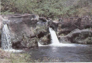
Size: 700 square kilometres. Distance from San José: 280 kilometers. Camping: Permitted. Trails: Yes. Dry season: January to March |
 |
 |
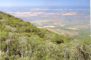
Guanacaste National Park, located on the east side of the Interamerican Highway across from Santa Rosa National Park, was created in 1989 to protect the volcano slope evergreen forest and the Orosi and Cacao volcanoes' cloud forests. This project was founded to help secure a migration route for those animals that move into the highlands during the dry season. The park contains several interesting trails and four research stations, of which at least one will remain open for tourists, researchers and photographers. |
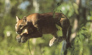
Wildlife in the park is varied; 140 species of mammals, over 300 birds, 100 amphibians and reptiles, and over 10,000 species of insects have been identified. The most common mammals are howler monkeys, white-faced capuchins, long-nosed armadillos and coatis. There are also collared peccaries, pocket mice, white-tailed deer, pumas, ocelots, black hawks, and many others. |
 |
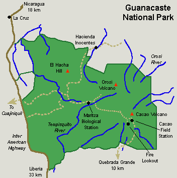 |
Positioned at the foot of the Orosi volcano lies Maritza Biological Station where one can find hills that are relics of Plio-Cuaternary volcanoes and plains formed by the accumulation of ash, pyroclasts and ignimbrites. The western slope of these volcanoes is covered with evergreen rain forests. Trees here can grow up to 30 meters in height, and the predominating species are the Santa María, Tempisque and the Monkey Apple. |


